New global ocean tide model EOT20 from multi-mission satellite altimetry
DGFI-TUM recently published the latest in a series of empirical ocean tide (EOT) models. The new model, named EOT20, shows improved results compared to other global tide models (including our earlier model EOT11a), especially in the coastal region.
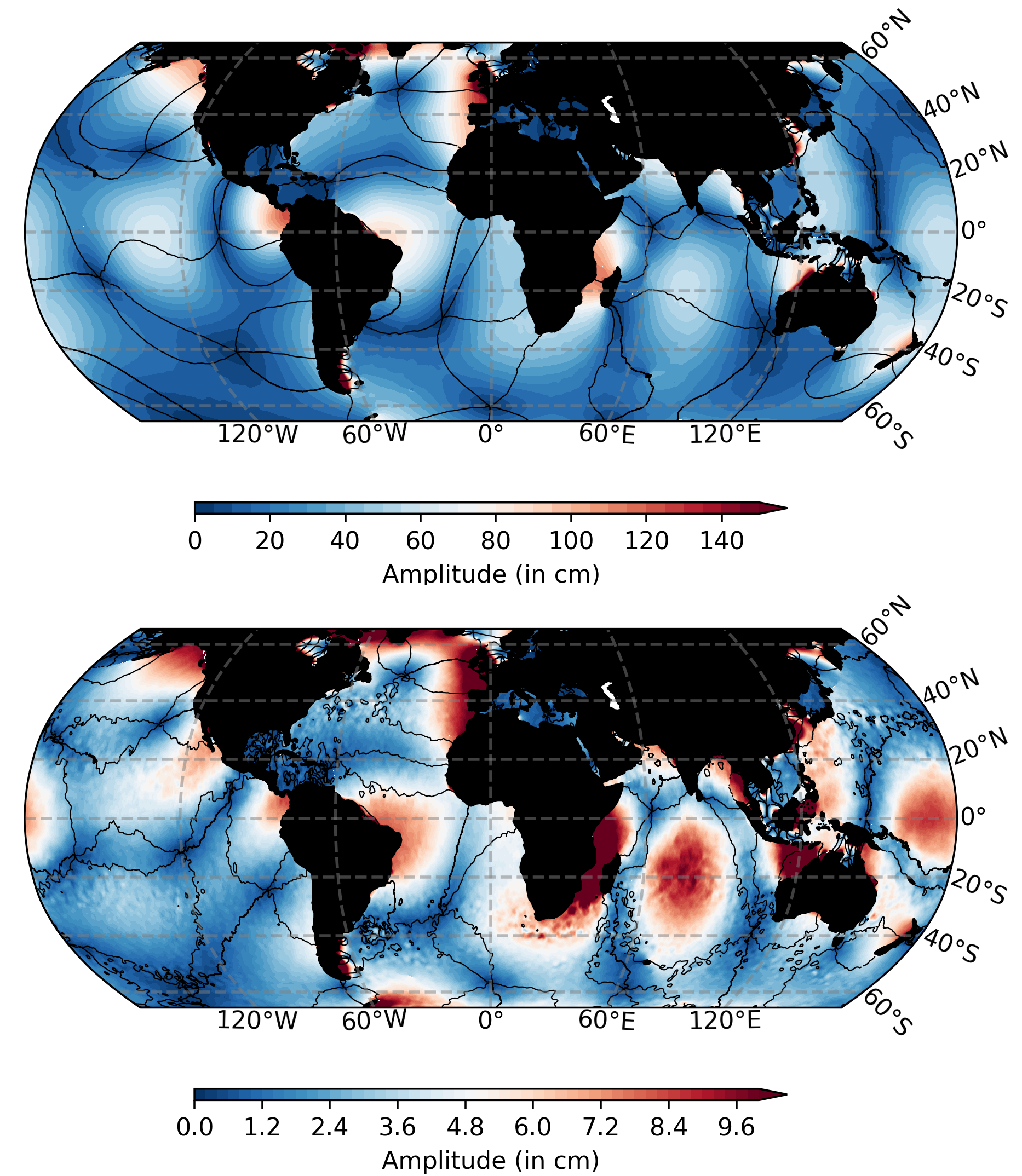
Ocean tides play a vital role in various practical applications, especially in the coastal environment. In addition, tides are of importance in geodetic data analysis, for example in improving the observation of sea surface processes from along-track satellite altimetry and in determining high-resolution gravity fields from missions such as GRACE. Although in recent years tide models have made significant progress in the estimation of tides using satellite altimetry, the coastal region remains a challenge due to the complexity of shorelines, poorly resolved bathymetry and land contamination of altimetry radar echoes.
EOT20 benefits from advances in coastal altimetry, particularly in the use of the ALES retracker. The EOT20 approach relies on residual tidal analysis with respect to a reference tide model (FES2014) to estimate residual signals of the ocean tides. Further developments include the incorporation of more altimetry data, improved coastline representation and triangular gridding.
The model's accuracy was evauated using in-situ tide gauge data from DGFI-TUM's TICON dataset. Error reduction was found for the eight major tidal constituents in EOT20 compared to other global ocean tide models in the coastal region, with an error reduction of ~0.2 cm compared to the next best model (FES2014). EOT20 is on par with the best tide models in shelf regions and the open ocean, with improvement over EOT11a throughout. When used as a tidal correction for satellite altimetry, EOT20 reduced the sea level variance compared to both EOT11a and FES2014. These improvements, particularly in the coastal region, encourage the use of EOT20 as a tidal correction for satellite altimetry in sea-level research.
The ocean tide and load tide datasets of EOT20 are available in our Science Data Products section. Methodology and results are described in the publication EOT20: a global ocean tide model from multi-mission satellite altimetry (Earth System Science Data, 2021, doi: 10.5194/essd-13-3869-2021, [PDF]).
Arcisstraße 21
80333 München