Novel multi-resolution representation scheme for regional gravity field refinement
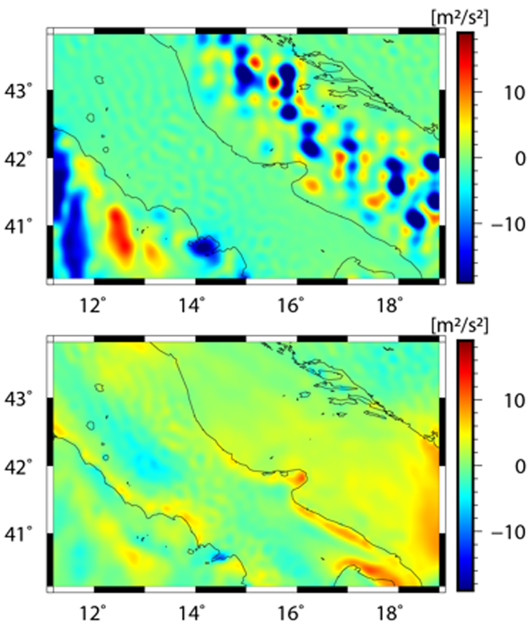
The optimal combination of different observation types is a key to obtaining high-resolution and high-precision regional gravity field models. Existing literature suggests that the single-level model based on spherical radial basis function (SRBF) may be biased toward high-resolution measurements. To avoid this effect, a spectral combination by a multiresolution representation (MRR) allows to decompose the gravity signal into an expansion in the form of spherical harmonics for the global long-wavelength part and a number of detail signals in the form of wavelet functions for the regional mid- and high-frequency parts.
The article Combination of different observation types through a multi-resolution representation of the regional gravity field using the pyramid algorithm and parameter estimation (Journal of Geodesy, 2022, DOI: 10.1007/s00190-022-01670-5) presents an innovative MRR method based on the pyramid algorithm and sequential parameter estimation. Instead of estimating the coefficients of the detail signals at each resolution level independently, the pyramid algorithm connects the different levels and estimates the coefficients sequentially. Numerical investigations based on simulated and real gravity data demonstrate the ability of the MRR scheme based on the pyramid algorithm to adequately capture gravity information not only from high-resolution terrestrial data, but also from medium- to low-resolution measurements. It actually provides a model accuracy improvement of more than 30% in terms of RMS error over validation data, compared to the single-level approach.
Arcisstraße 21
80333 München